EVENT: September 29, 2009 Samoa Islands Earthquake and Tsunami—On September 29, 2009, two large earthquakes struck midway between Samoa and American Samoa. The earthquakes generated tsunami waves of up to 22 meters (72 feet) that engulfed the shores, killing at least 192 people— in Samoa, American Samoa, and Niuatoputapu, Tonga. The earthquakes were felt in American Samoa for up to 3 minutes. Rapid responses from local officials, coupled with public recognition of a tsunami’s natural warning signs, saved numerous lives. Building on this foundation, continued preparedness efforts earned American Samoa official TsunamiReady recognition from the National Weather Service in 2012. The 2009 tsunami was the deadliest in history for American Samoa, Samoa, and Tonga, and the most damaging for American Samoa and Samoa.
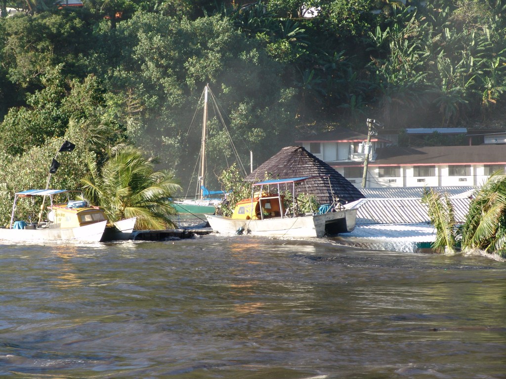
PHOTO DETAILS: Harbor flooding near Pago Pago Park with a boat on top of submerged structures. Image courtesy of Richard Madsen. https://www.ngdc.noaa.gov/hazardimages/#/tsunami/260/image/1806
More images from this event are available in the NCEI Natural Hazards Image Database. Any parties interested in contributing photographs to this free and public resource may contact NCEI for submission requirements at haz.info@noaa.gov or Lindsey Wright at lindsey.m.wright@noaa.gov.
Link to NCEI Natural Hazards Image Database: https://www.ngdc.noaa.gov/hazardimages/#/